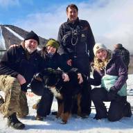
The Warren Planning Commission’s June 1, 2024, visioning session attracted a strong crowd on a sunny Saturday morning with folks ready to talk about the future of the town.
After coffee, donuts and socializing, the roughly 45 participants ranging in age from theirs 20s to their 80s, divided into four groups to share and consider a community vision suggestions for – Main Street, all of Warren Village, all of Warren’s connections to neighboring towns.
“Ideas like improving public transportation and access to affordable housing, as well as preserving green spaces, improving flood resiliency and the importance of community, were touched upon in each of the groups,” reported Warren Planning Commissioner Dan Raddock.
Here are some of the ideas that came out of the sessions:
- Make the village a pedestrian village, rather than one dominated by car and truck traffic.
- Put a bench at the bottom of Fuller Hill Road for public use, parents waiting for children on the bus, etc.
- Improve pedestrian access to the town offices and town green via stairs opposite the post office, adding paths, improving the church stairs.
- Improve access to the river and revive the swimming hole at the covered bridge.
- Narrowing bridges and travel lanes and use lighting to further calm village traffic.
- Use the current town garage and gravel pit as sites for workforce and/or affordable housing.
- Consider moving the fire station in the future to make space for housing.
- Explore whether the town could acquire and lease vacant buildings and lots in the village to increase vitality.
- Mitigate the impact of traffic, short-term rentals, noise.
- The importance of maintaining community and increasing vitality in the village.
Raddock said that some “deep future” ideas discussed included:
- Create an “East-West Bypass” running from the bottom of Sugarbush Access Road to the Warren Airport to route vehicular traffic past Warren Village rather than through the village.
- For flood damage mitigation, proactively identify points where water can be slowed and captured before it runs into the river, including creating a “Central Park” in East Warren between Senor Road and East Warren Road where six or more streams converge.
- The potential of the Mad River Path Association’s Route 100 right-of-way path project to create alternative, safer transportation routes in The Valley for bikers and pedestrians, while contributing to connectivity and economic vitality.
- Town support for commuter pick-up points to encourage ride sharing among drivers entering and leaving The Valley every morning and evening.
- Identify and preserve sensitive wildlife habitat and connectivity across town lines.
- Continue to support Waitsfield’s development of Irasville through Warren’s engagement in the Mad River Valley Planning District (MRVPD).
“Some of these ideas are already being explored or implemented by the town, the planning commission, and/or other local organizations Other ideas are suggestions for future consideration by the town, and will not necessarily be acted upon,” Raddock said.
The planning commission will follow up the visioning sessions by documenting the results, which will include creating new mapping, as well as ensuring the documents are publicly available on the town website.
Planning commissioners Jim Sanford and Adam Zawistowski, along with planning and zoning administrator Ruth Robbins coordinated the event.


